Church Minshull to Slaidburn (82 miles)
Today should be our most urban day as we work our way north from Cheshire into Lancashire and pick our way between the built up areas of greater Manchester sprawling westwards to link up with the eastward limits of the Merseyside conurbation. There will be some unavoidable main road stretches as well as countryside. There is high cloud first thing in the morning but the weather forecast is good so we only pack our light waterproofs and do not take the full stormy weather gear. We hope we are not tempting fate. We have a choice of route via Winsford or Middlewich. The Winsford CAB has not expressed any wish to see us at all and we decide to opt for Middlewich.
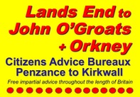
With the bike ready we wait for the huge milk bulk tanker to squeeze into the farmyard and turn around, then set off down the farm road, turn left and head over the canal to the A530. It is early morning travel to work time but the traffic is not too bad as we pedal north to Middlewich at a fast pace. In Middlewich we have no difficulty in keeping up with the traffic as we stomp around bits of one-way systems and roundabouts before leaving eastwards on the A54 looking out for our left turn to escape onto the B5081. The A54 is the busiest main road we are to encounter on the trip with a stream of 40 ton articulated trucks. They are courteous in waiting for a clear gap to overtake but we are still buffeted by the wind of these passing monsters. After about a mile I realise that we must have missed our turn, although there has definitely been no road junction, and pull into a petrol filling station to consult the map. We realise that since the map was drawn Middlewich has grown considerably and the built up area together with a new chunk of main road and roundabouts has engulfed the B5081 junction. We should have turned north at one of these roundabouts. We deduce that all of this heavy traffic is heading for the M6, which is less than one mile ahead, and decide that it will be less hassle to press on to Holmes Chapel and then take the A50 from there with a choice of either staying on that road to Knutsford, or of working our way back across the motorway to rejoin our intended route to Knutsford. Our supposition is correct and all of the heavy vehicles are left behind as we cross the M6 junction roundabout. We find the A50 in Holmes Chapel. It is a wide road and with little traffic so we stay with it all the way to Knutsford. These fast fairly flat roads are a new experience and we fly along at 20mph+ arriving in Knutsford with an average speed of 18mph since leaving our farm B&B. Knutsford has been a totally non-communicating CAB and we do not even have a current address so there is no point in trying to find the office. The most impressive civic building in town turns out to be the police station and law courts. We do a bit of riding and walking in the centre and take a slight detour to arrive at a new bus station where there are public toilets. Feeling slightly mischievous and having brought the Knutsford town sign with us, I fasten it to the bike and, in the absence of a CAB welcome, pose with the tandem in front of the door of the gents toilet while Sheila takes a photo. I then realise that this performance has been intently watched by an old chap sitting on a seat waiting for his bus to arrive. It is too difficult to explain so we do not try, but we imagine his conversation on arriving back home: “Do you know what I saw today at the bus station. Instead of the bus coming a tandem rolled into the bus bay for the number 34. One passenger got off and then the driver…….” No doubt to be put in his place by his wife with a sharp response of, “Don’t be so silly, you really should no longer be allowed into town on your own at your age” We leave town looking for the lane that will take us out around Tatton Park. Continuing northward we travel through Bucklow Hill (The name is a pretence – they don’t know what real hills are in this part of the country) and over the M56 towards Lymm. In Lymm there is another CAB that has given us the “we do not want you to call here” message (What a contrast to all the cups of tea and smiles on Tuesday) so we decide a detour into the town centre is not worth the fuss. As a result we save a few miles bypassing most of the town as we continue on the B5159. Our route takes us under the Bridgewater (this one with an e) Canal by a sharp right and left turn controlled by traffic lights and featuring a wet road and very drippy ceiling overhead. A few miles further on we cross the Manchester Ship Canal on a toll bridge (no charge for tandems). There are no ships in sight, but we stop for a photo for the record and to add to the interesting bridges collection. At Aston we take a photo of the road sign. Not a real county boundary sign this one but there was no sign on the road by which we entered Cheshire and it does at least acknowledge the existence of Cheshire. We continue on fairly fast flat roads and cross over the M6, skirt Culceth and travel on to Leigh. We use the CTC directions to find our way into the centre of Leigh. No problems in route finding, but the large Eagle and Child PH that marks a key right turn has been re-named. We pull up beside the central library and seek directions for the CAB. It is nearby, but we are not expecting to be offered hospitality at the bureau and so getting our priorities in order we ask passers by about a coffee shop recommendation. We are directed to a nearby street. The dress of the locals and the nature of the shops and other buildings convey the impression that there is not too much surplus wealth in Leigh. This is confirmed by the prices in the coffee shop. No one is going to pay Lymington High Street prices here. We park the tandem against the window and take a table inside. Service is friendly and being a bit confused as to whether we have now left Cheshire I ask for confirmation that Leigh is in Lancashire. This causes some measure of discussion before there is an agreed response. Clearly the locals are not pre-occupied by municipal arrangements and have probably been confused as well by a series of local government re-organisations. “Leigh is, well er, Leigh”. It is probably in Greater Manchester “because that is what the buses used to say before they all got different names”, and yes in bygone days they might have been part of Lancashire. I resist seeking confirmation that Leigh definitely is not in Yorkshire because there is no point in spoiling a friendly welcome. Feeling better for coffee and cake and the use of the loos, we depart to seek out the CAB office. I take a photo of Sheila + tandem, fill out the distance to Leigh CAB certificate and pop inside to deliver it to one of the receptionists in a very busy waiting room area. More towns to go so we head out of town, although we barely leave built up areas for a while as we skirt Atherton and traverse Westhoughton. There is a short spell of urban fringe countryside as we edge around the west of Bolton over the M61 and through Chew Moor where there is a vast pipeline laying project underway. We head up hill through Lostock Junction trying to spot the railway station that is a key landmark. Lostock is now effectively a suburb of Bolton with quite a bit of new housing and, although we don’t realise it yet, because of some radical re-organisation by the traffic planners we are not on the road we think we are as we approach the Bolton ring road. We come to a major roundabout and turn right onto the A673 heading for our left turn onto the ring road for a short spell. It is a wide dual carriageway and we sweep downhill over a railway and river and then climb up the hill beyond. Our turn is a bit of a long time coming, and it has not yet dawned on me that there should not have been a railway or river. At this point a fast pedalling cyclist on a mountain bike pulls alongside and we cycle side by side chatting. We say where we are going and he says, “No you aren’t”. After a bit more discussion we agree and the three of us stop to look at the map. Our right turn onto the A673 wasn’t - in fact because of the road change in Lostock we had already arrived at the ring road. So having turned the wrong way there we were now happily cycling the wrong way around Bolton. Sounds like a cycling version of the pensioner couple and the M25 story. I guess we would not have done a full 40 or so miles circuit before realising our boob. Maybe the fact that the sun was in quite the wrong place could have been a clue. Our fellow cyclist suggests we go through the centre of Bolton and use the main road to Blackburn, but we have no desire to collect extra Lancashire town centres and so say goodbye and cross the road to retrace our journey. Just to put things into perspective this is our only really embarrassing navigational boob of the tour. Although we miss other turns in tricky urban streets or on unmarked lanes none leads us far astray. And we do, of course, cycle 1,000 miles mostly on tiny roads making hundreds of turns at rural junctions devoid of signs without losing our way. Anyway, back on course it is not long before we pull off the ring road and head into countryside. There is an instant and dramatic change. We are on unfenced moorland and are climbing stiffly. Our way lies upward across Smithhills Moor and the sun is shining and there are larks singing overhead. We spot a pub at a crossroads ahead of us on the climb and, targeting it as our lunchtime stop, we forge up the hill knowing that there is a rest stop in sight. At Bob Smithy’s Inn we leave the bike outside and head in for lunch. Service is not too fast and it seems to take quite a long time for the table beside us, who were already there when we sat down, to be served. Likewise our meals are slower in coming than we would have liked, trying to balance the need for food and a break with not delaying for much too long a time. After all, important as lunch is, I do not want to take so long that other opportunities to stop, including afternoon tea, become squeezed out. Refreshed we depart and continue climbing across the moor before running around the contour line and making a fast downhill drop to join the A675. The views are wide open and we are able to time our left turn to avoid halting at the main road junction. As we came across the high moorland we enjoyed long views and in the distance could see Manchester against a Pennine backdrop. Because the sky is a mixture of grey and blue the view of Manchester was quite dramatic. Surrounded by darkness the city was dramatically lit in shafts of bright sunshine with all of the city centre tower blocks gleaming in the distance. Before we reach Blackburn it is a continuing rural ride. After passing through Belmont we leave the main road and continue on a quite small road through Tockholes, over the M65 (just a line of dashes on our map, but now finished and full of traffic) right to the outskirts of Blackburn. We are climbing as we go (in fact Bunker’s Hill even warrants one arrow) and arrive at the edge of town looking down across the built up area before dropping down as we pedal in towards the town centre. Route finding to the centre is fairly straightforward. The traffic is a bit busy as we weave through many sets of traffic lights under railway bridges. There seems to be lots of jockeying for position and edging out going on in a mix of traffic that includes a higher than normal proportion of boy-racer motors with flashy extras grafted onto not so new vehicles. Many of them are pulsating with multi-decibel sound systems. How anyone is aware of anything happening outside the car while bombarded with such a nerve deadening assault is beyond me. I ride positively but defensively and we try to make ourselves visible with our presence felt. We arrive at the edge of the traffic free central zone, dismount and wheel the bike into the pedestrian area. The centre of Blackburn sports all the features one would expect, including fine nineteenth century civic buildings such as town hall, civic hall, art gallery and library together with not so fine 1970s shopping centre redevelopment. The road builders have also had their way carving through a piece of inner ring road – Barbara Castle Way. I would have paid money not to have my name affixed to such an object, but maybe it is only this century’s version of what previous generations did when they engineered the Leeds and Liverpool Canal and Lancashire and Yorkshire Railway through town. The CAB office is close in to the centre located in a redundant church. Blackburn is a busy office and like other city centre CABx is well financed, has no need of publicity and has no time to meet us. Nonetheless, we take a photo and Sheila posts the distance certificate through the letterbox. I am intrigued by the power assisted door that is meant to be of assistance to disabled people but looks as though you might need to be pretty nippy with the wheel chair because it requires an initial pull and then swings out towards you. I try it out and in the process discover that our card has shot straight out of the bottom of the mail box. I take it inside to the waiting room and seeing a young woman come out of an office and light a cigarette I ask her if she is an advisor or client. She looks very warily at me (maybe a yellow jersey and red crash helmet is not common clothing, but surely I don’t actually look dangerous) but admits to being CAB staff, so I smile nicely, give her the card and ask if she will deliver it for me. I suspect it will be delivered to the waste paper bin, but no matter our mission is accomplished and we have ‘done’ Blackburn. We take a break for a snack taken sitting on a bench in the small open area (former churchyard?) beside the CAB and check out on the map how to leave town onto the Whalley New Road. This we accomplish without difficulty. The northern side of Blackburn, both shops and people on the streets, seems to be a 100% Asian population. As we approach the edge of town we are climbing again and looking for a small turn that should take us steeply up hill past reservoirs and back into countryside. For this part of the route I have plotted a way that avoids the more main road and flatter valley route suggested by the CTC in favour of tiny, but hilly lanes bumping along the edge of Pennine hills. This part of the route and the Forest of Bowland to come will almost certainly bring our overall average speed for the day back down from the high speeds we achieved earlier on the faster more main roads. From here on we begin another whole new chapter of scenery that is a complete contrast to the morning and early afternoon, and the sun is shining. Having climbed we wend our way along the contour line and then have a fast reasonably long downhill run to Whalley in the valley bottom. As we come further down there are a series of wickedly fierce speed bumps that we cannot escape. This is both annoying and jarring because I can keep our speed below the required 40mph without these added obstacles. At the bottom immediately before the road junction there is a very steep hairpin bend that almost doubles back underneath itself. I impress myself as with the brakes full on we manage to remain upright while slowly making the turn using every bit of available road width to accommodate the length of the tandem. I even more impress myself because at this very moment a police van in first gear and full lock turns off the main road towards us. But after a brief close scrutiny of its front grill and a smile through the windscreen at the occupants we squeeze past each other on the appropriate sides of the road maintaining full control and balance, and manage to unlock our feet from the spds at the junction stop line. Whalley is a fine historic small town complete with abbey and lots of visitors. We stop briefly to use the public loos and watch the activity. From here it is to be a real rural ride as we head out into the Forest of Bowland through super scenery and hilly terrain. We have some seriously challenging climbing to do for the final stretch before Slaidburn and so we promise ourselves that we will have a stop at Cow Ark beforehand. We pedal through Great Mitton and the scenery gets better and better as we travel on through Bashall Eaves. At Cow Ark we take our intended break at the road junction before the up and over climb that attacks the slope of the hills straight on. We stoke up on flapjack. We have a vast supply that Sheila cooked before we left Lymington, but are rationing it out as we go as the magic fuel for the really challenging bits. I hope that there is still plenty left when we get to Scotland. As always our efforts are rewarded with some great views and a compensating fast run down hill again before we complete the last few miles to Slaidburn. Our B&B is not in the village itself. Yes, you have guessed – it is at a farmhouse about a mile away off route and right at the top of a very steep hill. We walk up the first bit of the hill, pushing the tandem, then climb back on to ride the final half mile. The B&B is in a superb position. We are bathed in glorious evening sunshine and the views stretch forever. We are made welcome and given tea and cakes. I then replace the worn out brake blocks for new ones, tighten up anything that feels a bit loose and stow the tandem away in the coal shed. In the evening we walk back down into Slaidburn and have dinner in the "Hark to Bounty" pub. Slaidburn to Penrith |
 To Lands End
Prologue - Lands End to Ludgvan (17 miles) Day 2 Ludgvan to Trelill (64 miles) Day 3 Trelill to Great Torrington (55 miles) Day 4 Great Torrington to Bridgwater (67 miles) Day 5 Bridgwater to Chepstow (70 miles) Day 6 Chepstow to Ludlow (74 miles) Day 7 Ludlow to Church Minshull (77 miles) Day 8 Church Minshull to Slaidburn (82 miles) Day 9 Slaidburn to Penrith (62 miles) Day 10 Penrith to Eskdalemuir (62 miles) Day 11 Eskdalemuir to South Queensferry (71 miles) Day 12 South Queensferry to Blairgowrie (76 miles) Day 13 Blairgowrie to Tomintoul (67 miles) Day 14 Tomitoul to Alness (76 miles) Day 15 Alness to Bettyhill (76 miles) Day 16A Bettyhill to John O'Groats (59 miles) Day 16B John O'Groats to Kirkwall (22 miles) Arrivée Orkney and Home |
CYCLING NEW FOREST
